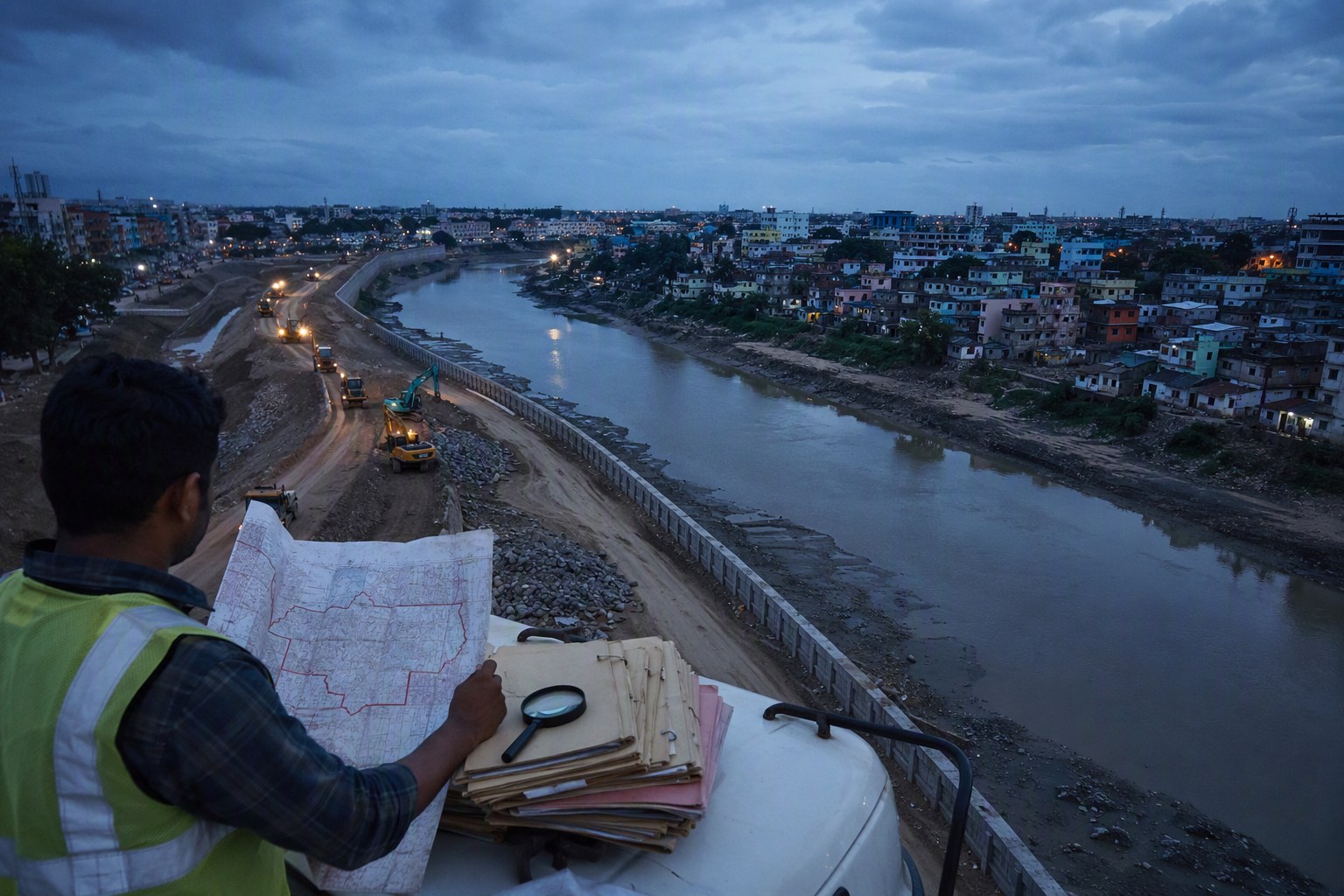
Telangana Drainage Upgrades May Start With 22-A Land Checks because nala widening, box-drain works and storm-water corridors are no longer just engineering exercises. In Hyderabad and surrounding mandals, the land status of every survey number can decide whether a drain line moves quickly or gets stuck between departments, SRO records, village maps and local objections.
The sharp point is Section 22-A. As per latest IGRS-linked data available with Verified.RealEstate, Telangana has 3,076,153 prohibited property records in the 22-A database. For public works teams planning drainage upgrades, this is not a side issue. A land parcel marked under 22-A can affect acquisition, permissions, compensation discussions, road-cutting approvals, nala alignment, and even the timing of tenders.
Our view is simple: before a drainage DPR is frozen, the corridor should be checked against 22-A status, survey numbers, EC history, land use and SRO records. Doing it after objections come is costly and avoidable.
Telangana Drainage Upgrades May Start With 22-A Land Checks: The Main Issue
Hyderabad’s drainage stress is visible in low-lying pockets of Kukatpally, Nizampet, Uppal, Nagole, Tolichowki, Bandlaguda, Hafeezpet, Alwal, Malkajgiri and parts of LB Nagar. In the growth belt, similar pressure is seen around Serilingampally mandal, Quthbullapur mandal, Gandipet mandal, Rajendranagar mandal, Hayathnagar mandal, Patancheru mandal and Medchal side villages.
When a nala has to be widened, the working drawing may pass through mixed land conditions: old gram panchayat layouts, patta lands, government lands, assigned lands, endowment-linked parcels, lake buffer areas, road margins and private plots with past registrations. If one stretch is under a prohibited category, the file cannot be treated like an ordinary private land transaction.
This is where a Section 22-A Prohibited Property Check becomes useful at the planning stage itself. It does not replace official verification, but it helps owners, consultants, contractors and local bodies identify red flags before money and time are spent on a final alignment.
Telangana Drainage Upgrades May Start With 22-A Land Checks Before DPRs
In our experience, many corridor disputes begin with one basic gap: the survey number is not properly matched with the ground location. A drain is marked on a map, but the revenue record may show another classification. The pahani may say one thing, the SRO record may show another transaction trail, and the local residents may produce older layout papers.
For nala widening, this mismatch can slow down three things. First, administrative sanction may require clearer land availability. Second, permissions from revenue, irrigation, municipal and registration-side offices may take longer. Third, affected owners may challenge the alignment if they believe their land has been wrongly treated as public corridor or buffer.
A sensible sequence is now emerging for Telangana drainage planning:
- Identify the exact mandal, village and survey numbers along the proposed drain corridor.
- Check whether any parcel appears in the 22-A prohibited property list.
- Match survey numbers with EC, pahani, Dharani entries and SRO jurisdiction.
- Review land use, road width, nala buffer and lake-related restrictions wherever relevant.
- Keep land-status notes ready before tendering or public notice stages.
For citizens and buyers near proposed public works, starting with a Survey Number Finder and then checking the Encumbrance Certificate Search can give a clearer picture of the property trail. If the land is close to a drain, lake, road-widening line or public corridor, do not rely only on a seller’s word.
What The 22-A Database Means For Nala Widening
Section 22-A deals with properties prohibited from registration. The reasons can vary by record and government classification. In practical terms, if a property is on this list, registration activity may be blocked or restricted unless the status is corrected or clarified through the proper authority.
| Planning Item | Why It Matters For Drainage Works |
|---|---|
| Section 22-A prohibited property records | 3,076,153 records as per latest available IGRS-linked data used by Verified.RealEstate |
| Survey number matching | Drain alignments depend on exact village and mandal-level land identity |
| SRO jurisdiction | Registration history and restrictions are tied to the correct SRO office |
| Ready reckoner or market value | Useful for compensation discussions, valuation review and public finance checks, without assuming private sale rates |
| Land use and road width | Can affect technical feasibility, access and permissions |
The count itself shows the scale of the issue. Telangana does not have a small prohibited-property universe. When drainage upgrades touch old city nalas, peri-urban layouts or revenue village boundaries, a 22-A check should be treated as a basic due-diligence step.
Hyderabad Localities Where Land Checks Can Change The Drainage Plan
Take Kukatpally and Hafeezpet. These areas have dense apartment development, old industrial pockets, nala crossings and heavy road usage. A drainage improvement line here cannot be viewed only through pipe diameter and gradient. The project team has to ask: which survey numbers are touched, which SRO covers them, and whether any parcel has a prohibited-property flag?
In Serilingampally mandal, land values and development pressure make even small corridor changes sensitive. Around Gachibowli, Kondapur, Nanakramguda and Financial District edges, a few metres can affect compound walls, access roads, basements and storm-water discharge routes.
In Gandipet and Rajendranagar mandals, the questions are different. Lake influence zones, village records, old layouts and approach roads matter. In Hayathnagar, Nagole and LB Nagar side pockets, nala carrying capacity, road width and historic encroachments can become the flashpoints. Quthbullapur, Kompally and Medchal belt areas bring another layer because industrial, residential and gram panchayat-era layouts often sit close together.
For a property owner in these areas, the practical checklist is not very complicated. Check prohibited status, EC, market value, SRO and land use. Verified.RealEstate tools such as Find Your SRO Office, Market Value / Guideline Value Search, Land Use Zone Finder and Road Width Check can help organise the first level of verification.
Why Early Verification Can Save Project Time
Drainage works usually face pressure only after flooding, resident complaints or monsoon damage. That is exactly when officials, contractors and local representatives are pushed to act fast. But land-status mistakes do not disappear because the work is urgent.
If a nala-widening corridor crosses a 22-A flagged parcel, officials may need clarification from revenue authorities. If the land is government-classified, assigned or linked to another restriction, compensation and execution rules can change. If private owners claim title through old documents, the EC and SRO record become relevant. If the road width is not enough for machinery access, the engineering plan itself may need revision.
We have seen buyers in Hyderabad focus heavily on amenities, UDS, floor rise and clubhouse charges, but ignore the drain behind the compound wall. That is risky. A property close to a nala, culvert, storm-water channel or proposed widening line needs extra checking. Builders also should be careful while marketing projects near such corridors; RERA details, land title and approvals must speak the same language. The RERA Project Lookup and Property Verification Tool are useful starting points for that review.
What Buyers, Owners And RWAs Should Do Now
If your apartment, plot or commercial property is near a drain, do not wait for excavation machines to arrive. Ask for the survey number, village name, mandal and SRO. Check whether any notice has been issued by the municipality, GHMC, HMDA, irrigation or revenue department. Review the EC and compare it with the seller’s documents.
Resident welfare associations in areas like Nizampet, Manikonda, Puppalaguda, Bachupally, Miyapur, Uppal and Alwal should maintain a simple file with layout approval copies, nala maps if available, past municipal correspondence and affected survey numbers. During public consultations or site inspections, this kind of documentation carries weight.
For landowners, a 22-A entry should not be ignored or treated casually. Sometimes the entry may need correction. Sometimes the classification may be valid. Either way, the answer has to come from the proper government record, not from neighbourhood talk. For any high-value transaction near an infrastructure corridor, use an advocate, check the SRO, and verify the revenue trail before paying advance.
The Bigger Takeaway For Telangana Drainage Upgrades
Telangana needs drainage upgrades in fast-growing urban and peri-urban pockets, but better drains need clean land intelligence. Section 22-A checks, survey-number mapping, EC review and ready reckoner value verification should sit at the front of the process, not at the dispute stage.
My opinion: drainage planning in Hyderabad should become survey-number first. Engineers can design the drain, but land records decide whether the work moves on ground. With 3,076,153 prohibited property records in the state-level dataset, skipping 22-A verification is not a small oversight. It is a project risk.
Frequently Asked Questions
What is the link between Telangana drainage upgrades and 22-A land checks?
Drainage and nala-widening works often pass through multiple survey numbers. If any affected parcel is listed under Section 22-A prohibited properties, permissions, compensation, alignment and execution timelines may be affected.
How many prohibited property records are there in Telangana?
As per the latest IGRS-linked data available with Verified.RealEstate, Telangana has 3,076,153 Section 22-A prohibited property records.
Which details should I check if my property is near a nala?
Check the survey number, village, mandal, SRO jurisdiction, EC, 22-A status, land use and road width. If any public notice or widening proposal exists, keep copies and take legal advice before selling, buying or constructing.
Can a 22-A entry be removed automatically for a drainage project?
No. A 22-A status needs proper verification through government records and the competent authority. A public project may require separate approvals, but the land-status issue cannot be assumed away.
Which Verified.RealEstate tools help with first-level checking?
You can start with the Section 22-A Prohibited Property Check, Survey Number Finder, EC Search, Find Your SRO Office, Market Value / Guideline Value Search, Land Use Zone Finder and Road Width Check.