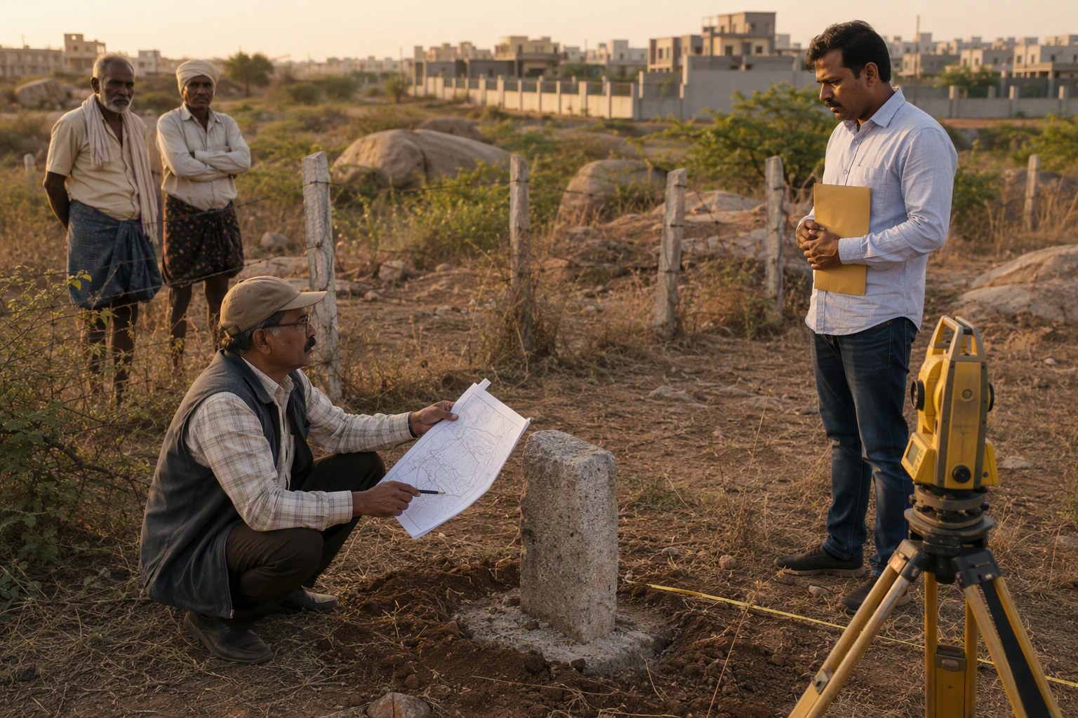
Telangana Registrars Explain Why Old Survey Maps Matter
Telangana Registrars Explain Why Old Survey Maps Matter because the land you are seeing on Google Maps, the plot you are standing on, and the survey number written in the sale deed may not always tell the same story. That gap is where many Hyderabad and Telangana buyers get trapped, especially when token money is paid before checking old village maps, FMB sketches, pahani records, dharani entries, SRO documents and Section 22-A status.
The message from registrars, private surveyors and title lawyers is blunt: before paying even a small advance, compare the old survey map with the present revenue and registration records. If the old map shows a cart track, kunta, shikam land, assigned land marking, government boundary, nala, burial ground, temple land, or a different sub-division pattern, the buyer must pause. In our experience, this one step can save months of police station visits, civil court stress and repeated trips to the mandal office.
This issue is not limited to remote villages. We have seen buyers raise map-related doubts in fast-moving belts around Gachibowli, Kokapet, Narsingi, Tellapur, Mokila, Shankarpally, Maheshwaram, Adibatla, Tukkuguda, Shamshabad, Shadnagar, Medchal, Ghatkesar, Bibinagar and Patancheru. Wherever agricultural land became plotted layout land, old survey maps still matter.
Telangana Registrars Explain Why Old Survey Maps Matter Before Token Money
Registration officials generally do not re-survey land at the time of registration. Their office checks documents, stamp duty, parties, identification, registration rules, market value and restrictions visible in official systems. That does not mean every boundary on ground is correct.
A senior registration-side professional put it to us in simple words: the SRO can register a document if it satisfies registration requirements, but the SRO is not standing inside the land with a chain and GPS instrument. Boundary truth usually sits in revenue and survey records.
This is why an old survey map becomes so valuable. It gives the historical shape of the survey number, the neighbouring survey numbers, access points, water bodies, government strips and village features. When compared with current dharani records, pahani, EC and the sale deed chain, it can expose mismatches before the buyer’s money is locked.
For a first-level check, buyers can start with Survey Number Finder, then use Encumbrance Certificate Search and Section 22-A Prohibited Property Check. These tools do not replace field verification, but they make the first conversation with the seller far sharper.
Telangana Registrars Explain Why Old Survey Maps Matter In Section 22-A Checks
One reason officials keep stressing old maps is the scale of restricted property records. Verified.RealEstate database carries 3,076,153 prohibited property entries under Section 22-A. That number alone should make buyers careful. A property may look clean on ground, have a compound wall and even have previous sale deeds, but if it falls under a restricted category or overlaps with a prohibited survey number, registration or future resale can become painful.
Section 22-A entries can relate to several categories, including government land, assigned land, endowment property, wakf-related land, ceiling surplus land and other restricted parcels as per government records. The buyer’s risk is higher when a plotted venture uses part-survey numbers, old village names, merged survey numbers or unclear sub-divisions.
Registrars say buyers often ask only one question: “Registration aythunda?” That is too weak. The better question is: “Does the land shown on the old survey map match the current title, possession and registration record?”
Our opinion is simple: if the seller cannot show the old survey sketch, current pahani, dharani details, link documents, EC and SRO jurisdiction clearly, do not rush the token. A genuine seller may need time, but they will not object to proper verification.
What Old Survey Maps Actually Show
Old survey maps are not decorative papers. In Telangana property due diligence, they may be the most honest witness available. Depending on the village and record type, buyers and surveyors may refer to FMB sketch, tippon, village map, Sethwar-related references, town survey records or revenue sketches.
These records can show the original survey number shape, sub-division marks, boundary stones, neighbouring survey numbers, roads, cart tracks, tanks, kuntas, nalas, vagu, patta boundaries and sometimes land classification clues. When land has passed through family partitions, GPA sales, layout development, mortgage, court case or conversion, the old map helps identify whether the present document chain is sitting on the same land parcel.
A title lawyer we spoke to said most buyers read only the latest sale deed. That is like reading the last page of a court file and assuming the full story is clean. The old survey map gives the earlier geography of title.
For buyers dealing with Hyderabad outskirts, the following areas need special attention:
- Gandipet mandal: Kokapet, Narsingi, Manchirevula and surrounding high-value land pockets.
- Serilingampally mandal: Gachibowli, Nanakramguda, Raidurg and Kondapur belt where old village boundaries still matter in title reading.
- Shankarpally mandal: Mokila, Kondakal and surrounding plotted land corridors.
- Maheshwaram mandal: Tukkuguda, Mansanpally and airport-side growth locations.
- Shamshabad mandal: Shamshabad, Satamrai and neighbouring revenue villages.
- Medchal and Ghatkesar belts: layouts, HMDA approvals and old survey references must be matched carefully.
Common Red Flags Registrars And Surveyors See
Map mismatch rarely appears as one dramatic fraud. Usually it starts with small inconsistencies. A buyer sees Survey No. 112 in the agreement, but the old map shows Survey No. 112 split differently. The seller says the approach road is private, but the map shows a cart track passing through another survey number. The layout brochure says east-facing plot, but the FMB sketch suggests the plot falls near a nala line. These are not small clerical doubts. They affect title, access, resale and bank loan comfort.
| Red flag | What it may mean | What buyer should do |
|---|---|---|
| Survey number shape differs from old map | Wrong parcel, wrong sub-division or boundary shift | Ask for licensed surveyor demarcation and mandal-level record check |
| Old map shows nala, kunta or tank feature | Possible water body or buffer issue | Check land use, revenue classification and local authority records |
| Seller gives only latest sale deed | Link document chain may be weak | Check EC, parent documents, pahanis and title flow |
| Different village name in old and current papers | Village merger, SRO boundary issue or wrong record reference | Confirm with SRO Village Directory and local revenue office |
| Part-survey sale without sketch | Undivided or unclear land portion | Do not pay token until boundaries are identified on map and ground |
How Buyers Should Compare Old Survey Maps With Current Records
Buyers need not become survey experts, but they should follow a disciplined sequence. In our experience, the order of checking matters. If you begin with negotiation and token payment, documents become an afterthought. If you begin with survey number verification, the seller’s seriousness becomes visible immediately.
1. Start with the exact survey number and village
Do not accept vague descriptions like “near ORR”, “beside villa project” or “one acre in Mokila side”. Ask for the exact village, mandal, survey number, sub-division number, extent, pattadar name and SRO. If the land is in a plotted layout, ask for the parent survey numbers and approval reference.
Use Property Verification Tool for a structured check and Find Your SRO Office to identify the registration office linked to the property village.
2. Pull the EC and read the chain
An Encumbrance Certificate is not a title certificate, but it is a useful timeline. Check whether the seller’s name appears properly, whether prior transactions match the claimed extent, and whether there are mortgages, court attachments or unusual transfers. For a cleaner reading, buyers can use EC Analyzer.
3. Compare old FMB or village map with site boundaries
This is the heart of the exercise. Ask a licensed surveyor to overlay or compare the old survey sketch with current ground possession. The surveyor should check boundary stones, road access, adjacent survey numbers and any natural features. If the site visit is done only by a marketing person, it is not verification.
4. Check pahani, dharani and land classification
Pahani and dharani entries help identify current pattadar details, nature of land and revenue history. A clean-looking sale deed is not enough if revenue records tell a different story. In village lands around Hyderabad, pahanis are often the first place where old disputes show their shadow.
5. Check market value only after title comfort
Many buyers start with price. I prefer starting with identity of land. Once the land identity is clear, check ready reckoner or guideline value using Market Value / Guideline Value Search. Then estimate registration cost using Stamp Duty Calculator. Paying the right stamp duty on the wrong property is still a bad purchase.
Why This Matters More In Hyderabad Growth Corridors
Hyderabad’s expansion has pushed buyers into revenue villages that were earlier agricultural. Kokapet and Narsingi became premium addresses. Tellapur and Kollur moved quickly from open land to apartment and villa markets. Mokila, Kondakal and Shankarpally attracted plotted development. Tukkuguda, Maheshwaram and Shamshabad gained attention due to airport-side connectivity. Medchal, Kompally, Ghatkesar and Bibinagar saw a mix of layouts, warehouses, farm plots and investment land.
In such places, one survey number may have gone through inheritance, oral partitions, unregistered family arrangements, layout carving, road widening discussions, mortgage and resale. The latest brochure may be glossy, but the old map may quietly show a different road alignment or a missing sub-division.
Registrars are seeing smarter buyers now, but token-money culture remains risky. A buyer pays a small amount to block the deal, then discovers the land is under 22-A doubt, or the access road is not part of the seller’s title, or the plotted area does not match the parent survey sketch. Recovering token money becomes a separate negotiation.
What Title Lawyers Want Buyers To Ask Sellers
A good property conversation should sound a little uncomfortable. If the seller is genuine, they will answer. If they are only pushing urgency, they may avoid documents. Title lawyers suggest asking these questions before token money:
- What is the exact survey number, sub-division number, village and mandal?
- Can you share the old FMB sketch or village map reference?
- Does the current site boundary match the old survey map?
- Are all link documents available from the earliest traceable owner?
- Does the EC support the ownership chain?
- Is the land listed under Section 22-A or any prohibited category?
- Is there any court case, family dispute, mortgage or pending loan?
- If it is a layout, what is the approval authority and parent survey number?
- Who is giving physical possession and how is access legally established?
For apartment buyers, the same thinking applies at project level. Check the land title behind the project, not only the flat number. For registered projects, use RERA Project Lookup and ask whether the developer has clear rights over the land parcel shown in approvals.
Registrar Office Is Not A Substitute For Buyer Due Diligence
This is where many buyers misunderstand the system. Registration is a legal act of recording a document. It is not a government guarantee that every historical boundary, family claim or land classification issue is fully resolved. The registrar’s office works within the document and system checks available to it.
That is why old survey maps matter. They connect paper title with ground reality. A sale deed describes land through survey number, extent and boundaries. The map tests whether that description sits where the seller says it sits.
We have seen cases where the EC looked acceptable, the seller had possession, and the price was attractive. The issue came only when a surveyor compared the old map and found that the land being shown to the buyer was shifted slightly into a neighbouring survey number. Such issues are not always fraud. Sometimes they are old family arrangements, informal fencing or village-level understanding. But banks, courts and future buyers may not accept informal understanding.
Practical Checklist Before Paying Token Money
If you are buying land, a villa plot or a redevelopment share in Telangana, follow this simple checklist before paying advance:
- Collect sale deed copies, link documents, EC, pahani, dharani details and old survey sketch.
- Check Section 22-A status using Section 22-A Prohibited Property Check.
- Confirm SRO and village mapping through SRO Village Directory.
- Ask a licensed surveyor to compare old map with current ground boundaries.
- Check access road ownership, not just physical road availability.
- Verify land use and local planning restrictions using Land Use Zone Finder.
- If construction is planned, check road width through Road Width Check.
- Do not rely only on broker screenshots, layout images or verbal assurances.
- Keep token terms written clearly, including refund if title or survey verification fails.
My view is firm: a buyer should be ready to lose a “hot deal” rather than enter a cold dispute. Hyderabad land will always have another opportunity. Clean title is harder to find than a bargain price.
Final Word From The Field
Old survey maps matter because land is physical, not just digital. Dharani, SRO records, pahanis, ECs and sale deeds are all necessary, but the old map gives location memory. It tells you how the village originally understood that land parcel.
Telangana registrars, surveyors and title lawyers may speak from different offices, but their advice meets at one point: do not pay token money until the old survey map, present revenue record and ground possession agree with each other. If they do not agree, slow down. Ask better questions. Bring in a surveyor and a title lawyer. The safest property purchase is usually the one where the buyer is not in a hurry.
Frequently Asked Questions
Why do Telangana registrars say old survey maps matter?
Old survey maps show the original shape, boundaries, neighbouring survey numbers, access points and village features. They help buyers confirm whether the land shown on ground matches the sale deed, pahani, dharani and SRO records.
Should I check old survey maps before paying token money?
Yes. Token money should be paid only after basic title and survey checks. If the old map shows a different boundary, nala, kunta, government land marking or unclear sub-division, the buyer should pause and verify.
Is an Encumbrance Certificate enough to prove clear title?
No. An EC shows registered transactions and encumbrances for the selected period, but it does not prove ground boundaries or land classification. Buyers should also check old survey maps, pahanis, dharani records, link documents and Section 22-A status.
What is the risk if the old survey map and current site do not match?
The buyer may be looking at the wrong parcel, shifted boundaries, disputed access, part of a prohibited property, or land affected by water body or government land records. Such mismatch can affect registration, bank loan, construction and resale.
Who can verify old survey maps in Telangana?
A licensed surveyor can compare old maps with ground boundaries. A title lawyer can read the sale deed chain, EC, pahani and dharani records. For official revenue records, buyers may need to approach the concerned mandal revenue and survey offices.